
A transect for sprawl: can classifying suburban streets help London rethink its edges?
A planner’s thought experiment proposes a tiered system for rating commercial and residential streets by walkability. Could a similar taxonomy help London boroughs assess suburban retrofit priorities?
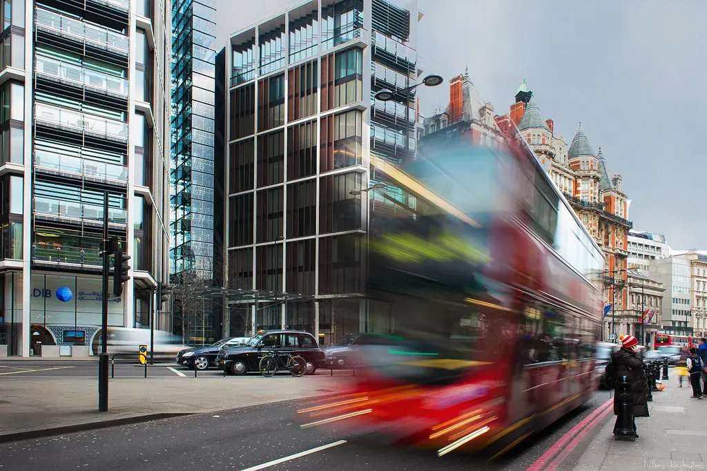
A new thought experiment in urbanist media proposes a tiered system for classifying the walkability of suburban streets, from nearly acceptable to actively hostile for pedestrians. The scheme, outlined by planner and law professor Michael Lewyn, adapts the New Urbanist transect concept—normally used to describe zones from natural to dense urban—to create a taxonomy of sprawl.
For London readers, the exercise is more than academic. Outer London boroughs such as Hillingdon, Havering, Bromley and Bexley contain large areas of mid-century suburban housing, commercial strips designed around car access, and road layouts that make walking impractical. As the Mayor of London’s Transport Strategy pushes for 80 per cent of all trips to be made by active or public transport by 2041, understanding which streets are most hostile to pedestrians—and which are closest to being fixed—could help boroughs prioritise improvements.
Commercial streets: from CS1 to CS4
Lewyn’s commercial sprawl transect begins with CS1, a borderline case: a three- or four-lane road that is wide enough to feel dangerous but is mitigated by buildings close to the pavement, medians or street trees that create a sense of enclosure. He gives the example of Second Avenue in Manhattan’s Yorkville, a street that is wide but still feels walkable.
CS2 is a garden-variety stroad: a four-lane road without mitigating features, common in older US suburbs. CS3 covers six-lane or wider roads that expose a pedestrian to fast-moving traffic for longer crossing times. CS4 describes the worst case: eight- or ten-lane roads where commercial buildings are set back behind parking lots, forcing additional crossing distance.
Lewyn also introduces intermediate zones: CS2.5 for roads where width is partly mitigated by medians or building proximity, and CS3.5 for six-lane roads with a central median that still feel dangerous.
Residential streets: from RS1 to RS4
The residential transect uses three factors: distance to walkable commercial destinations, street connectivity, and the presence or absence of pavements or walkable grass verges.
RS1 describes streets that are a little too far from shops—around a 10–15 minute walk—to be truly walkable. RS2 covers typical 1920s–1940s suburbia with interconnected streets and pavements but poor access to shops. RS3 represents mid-century layouts where pavements are missing but grass verges provide an alternative, and commercial streets are within walking distance. RS4 is the worst case: no pavement, no verge, and woods or fences directly abutting the road.
Key facts
| Element | Detail |
|---|---|
| Author | Michael Lewyn, professor at Touro Law Center, New York |
| Concept | A transect-based classification of sprawl streets by walkability |
| Commercial tiers | CS1 to CS4, with intermediate CS2.5 and CS3.5 |
| Residential tiers | RS1 to RS4, with intermediate RS2.5 and RS3.5 |
| Primary factors | Road width, mitigating features, pavement presence, distance to shops |
What this means for London
London’s suburban streets are not identical to US examples, but the taxonomy raises questions that are directly relevant to borough planning departments.
Outer London contains many roads that would likely score as CS2 or CS3 under Lewyn’s system. The A406 North Circular, A316 Great Chertsey Road and A23 Purley Way are multi-lane highways with limited pedestrian crossings and commercial units set back behind car parks. The A10 in Enfield, the A127 in Redbridge, and sections of the A20 in Lewisham all feature long stretches of car-oriented retail with wide carriageways and poor pedestrian infrastructure.
The Mayor’s Healthy Streets approach already uses a set of indicators to assess street quality, including pedestrian crossing difficulty, traffic volume and air quality. A walkability transect could complement this by providing a simple tiered label that helps boroughs identify which streets need the most urgent retrofit.
For residential streets, London’s interwar and postwar estates vary enormously. Some, like the Becontree estate in Barking and Dagenham, have interconnected street patterns and pavements but are far from shops. Others, such as certain cul-de-sac developments in Hillingdon or Bromley, lack pavements entirely and force pedestrians onto grass verges or the carriageway. A transect classification could help boroughs decide where to invest in new pavements, crossings or local centre improvements.
Retrofit and form-based coding
Lewyn notes that other commentators have used a transect of sprawl to think about retrofitting—making suburban streets more walkable. His purpose here is descriptive, not prescriptive. But for London planners, the descriptive tool has practical value.
Boroughs such as Croydon, Barnet and Ealing are already pursuing suburban densification through small-site development and high street renewal. Knowing which streets are in the CS3 or RS3 range—where the gap between existing conditions and a walkable standard is largest—could help target resources. A street rated RS2.5 might need only a new pavement and a crossing upgrade to become genuinely walkable, while an RS4 street on a large estate might require a more comprehensive redesign of the road layout.
The Mayor’s Housing Strategy and the London Plan encourage development on brownfield land, much of which is in suburban locations. A walkability transect could be used as a quick diagnostic tool when assessing planning applications: does the proposed development improve the street’s transect score, or does it lock in the current level of car dependency?
Limitations and unknowns
The scheme is a single author’s proposal, not an adopted planning tool. It is based on US examples and would need adaptation for UK conditions: narrower roads, different building typologies, and a regulatory framework that includes the Manual for Streets and the London Plan’s Healthy Streets indicators.
Lewyn also acknowledges the hardest case: streets that are walkable in isolation but sit alongside major roads that are hostile to cross. A residential street with a high Walkscore may still be dangerous to cross because of a nearby CS3 or CS4 commercial road. His proposed label for such streets—CSM3, or Commercial Sprawl Mixed Use—adds complexity that may reduce the scheme’s practical usefulness.
For London boroughs, the immediate value may lie not in adopting the exact classification but in the question it poses: which streets in our area are most hostile to walking, and what would it take to move them one tier up?
Source: Planetizen, “A Transect of Sprawl” by Michael Lewyn, 25 September 2026. https://www.planetizen.com/blogs/138486-transect-sprawl
Fuente
Planetizen News Publicacion original: 2026-09-25T12:00:00+00:00
Related updates

Seattle-Area Race Highlights Diverging Approaches to Housing, Transit and Tech Taxation
A Washington State legislative race in the 32nd District pits incrementalism against urgency on housing supply, transit funding and tech regulation, with…
Read update
New York court ruling on sanctuary policies carries implications for city-level immigration enforcement across the US
A federal judge has dismissed the Trump administration’s attempt to override New York City’s restrictions on immigration enforcement cooperation, citing state sovereignty.…
Read update
Automated license plate readers raise privacy, contract and oversight questions for UK cities
A new US-focused analysis of automated license plate recognition cameras highlights contract, privacy and oversight issues that London boroughs and Transport for…
Read update
Oregon’s “fix it first” dilemma: what London’s transport planners can learn from a revolt against megaprojects
Surveys show Oregonians overwhelmingly want existing roads repaired before new megaprojects are funded, and trust in the state’s transport agency has collapsed.…
Read updateWiki relacionada

Urban Planning Terms: Density, Public Realm and Transit-Oriented Development
A living glossary for terms that appear again and again in planning and development stories.
Read update