
Brooklyn’s Kent Avenue bike lane crisis: what London’s cycling planners should watch
A once-celebrated two-way protected bike lane in Brooklyn has become so congested that it is effectively unusable at peak times. The story holds lessons for London as cycle usage surges on the capital’s own superhighways.
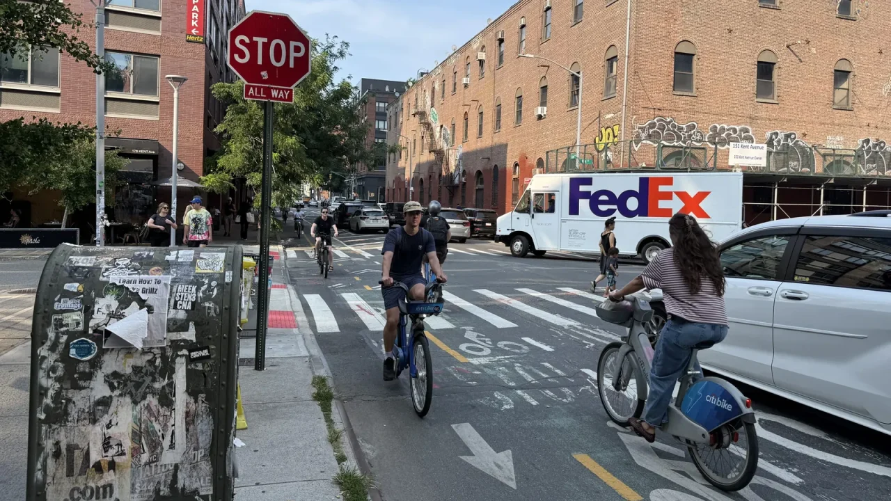
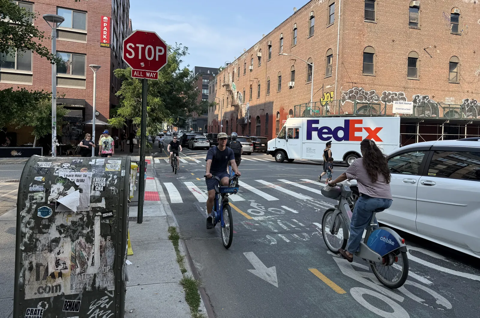
A signature New York City bike lane that was once a model for safe, protected cycling has become a victim of its own success. The two-way route along Kent Avenue in Brooklyn, connecting Greenpoint to Williamsburg, now carries more than 3,500 daily cyclists – a 35 percent increase since 2017 – yet its physical dimensions have not changed since it was installed in 2009. The result is a lane that is routinely blocked by pedestrians, forced into conflict with turning vehicles, and so narrow that cyclists cannot safely pass or park.
For London’s transport planners, borough officers and campaigners, the Kent Avenue story is a cautionary tale. The capital’s own cycle superhighways – particularly the East-West and North-South routes – have seen similar leaps in usage following the post-pandemic cycling boom, and the same pattern of infrastructure that was adequate a decade ago now straining at peak hours. The difference is that New York’s Department of Transportation is only now “exploring ways to improve the busiest sections”, while London’s TfL has already begun widening some sections of CS2 and CS3. Yet the pace of retrofit may not keep up with demand.
Key facts
| Data point | Value | Source |
|————|——-|——–|
| Daily cyclists on Kent Avenue bike lane (2026) | 3,500+ | DOT data cited by Streetsblog |
| Increase in usage since 2017 | 35% | DOT data |
| Cars, buses and motorcyclists counted on roadway (N. 4th St) | 196 | Streetsblog count |
| Cyclists counted in bike lane at same location | ~300 | Streetsblog count |
| Last significant lane upgrade | 2009 | Streetsblog |
The congestion problem in detail
Streetsblog’s on-the-ground count at the corner of N. Fourth Street found 196 motor vehicles on the roadway compared with nearly 300 cyclists in the bike lane – a ratio that would have been reversed five years ago. The lane is protected by a parking lane and occasional jersey barriers, but in the busiest sections near the Williamsburg waterfront the protection is minimal. Cyclists report that the lane is too narrow to allow safe overtaking, and that pedestrians often step into it because crossing points are poorly marked. At intersections without stop signs or traffic signals, conflicts are frequent.
New York City Council member Lincoln Restler, who represents the neighbourhood, told Streetsblog: “We’ve experienced a major boom and we need our infrastructure to keep up with it. That means a wider bike lane and a safer street for everybody.” Restler has been calling for a widening since at least 2021. The failure to act, he argues, is part of a broader pattern: when the city rezoned Williamsburg for dense residential development, it did not install the traffic-calming measures needed to make the new streets safe for the thousands of new residents, many of whom travel by bike.
Why the lane became overwhelmed
The Kent Avenue bike lane was installed in 2009, before the current cycling boom and before the large-scale redevelopment of the Williamsburg waterfront. Since then, the neighbourhood has added more housing than any other community district in New York, according to Restler. The lane was cutting edge for its time, but the corridor now serves a much denser population with a much higher cycling mode share. Jon Orcutt, a former DOT official and author of a 2024 advocacy letter calling for a wider lane, said: “The bike lane was great, but it’s been overwhelmed. The bike lane was cutting edge in 2010, but the avenue and usage of bikes in the city has exploded.”
The 2024 letter recommended that one of the two parking lanes be repurposed to widen the cycle lane. That proposal has not yet been implemented. DOT spokesperson Vincent Barone said the agency is “exploring ways to improve the busiest sections where we see the highest volumes of pedestrians and cyclists and will be working with the community on any upgrades.”
What this means for London
London’s cycle superhighways have experienced a similar surge. TfL’s annual cordon counts show that the East-West route through Hyde Park and the North-South route past the Elephant & Castle now carry more than 10,000 cyclists on some weekdays. Sections of CS3 that were built with a 1.5‑metre lane width are now uncomfortably narrow at peak times, and complaints about pedestrian–cyclist conflicts on shared-use sections of the Queen’s Walk are common. TfL has committed to widening some sections, but the process is incremental and funding is tied to the Mayor’s Transport Strategy.
The Kent Avenue case underlines that a protected lane, once installed, cannot be left unchanged for a decade and a half if the neighbourhood around it is being rezoned for higher density. London’s boroughs, many of which are now developing Local Cycling and Walking Infrastructure Plans, will need to consider how to build in headroom for future growth rather than retrofitting under pressure. The same lesson applies to the planned new cycle routes along the Thames Path and in outer London: capacity projections should account for the possibility that mode share will exceed central forecasts.
Observations from the street
Streetsblog’s ride-along documented multiple near-misses, including a left-turn collision with a reporter. Cyclists reported that the lane’s protection disappears exactly where it is most needed: near the waterfront parks, new apartment towers and grocery stores where activity is highest. One section south of Clymer Street does have a grade-separated lane with a buffer zone and trees, but that model has not been replicated along the rest of the corridor.
The pattern is familiar to London cyclists who use the CS2 section between Bow and Stratford, where a narrow protected lane squeezes past bus stops and junctions without priority. The difference is that London’s routes are usually designed with wider buffers and larger junction treatments, but the same problem of pinch points appears wherever the original design was not sized for the current volume.
Source: This article is based on a Streetsblog NYC report, “Eyes on the Street: It Is Time For Kent Avenue To Be Car-Free” (July 31, 2026), supplemented by public data from the New York City Department of Transportation. The London comparison is drawn from TfL’s published cycle counts and the author’s knowledge of the capital’s cycling infrastructure. The original New York article can be read at https://nyc.streetsblog.org/2026/07/31/eyes-on-the-street-no-kars-on-kent-edition.
Datos clave
| Punto | Detalle |
|---|---|
| Fuente | Streetsblog NYC |
| Fecha | 2026-07-31T04:02:00+00:00 |
| Tema | Eyes on the Street: It Is Time For Kent Avenue To Be Car-Free |
Fuente
Streetsblog NYC Publicacion original: 2026-07-31T04:02:00+00:00
Related updates

California’s unused dam safety powers hold lessons for London’s ageing flood infrastructure
A California audit reveals the state has never used its enforcement powers against dam owners, despite 57 dams in poor condition. As…
Read update
New York Poll Shows Overwhelming Bipartisan Support for Apartments Near Transit, Highlighting Contrast with London’s Own Housing Debate
A new poll from Open New York finds 79% of voters support building multi-family homes near rail stations, as the governor’s race…
Read update
Seattle City Attorney Launches New Community Court and Repeat Offender Programme Amid Public Defender Concerns
Seattle City Attorney Erika Evans has launched Connection Court, a new community court programme, alongside a punitive High-Priority Repeat Offenses system. The…
Read update
Seattle’s Centers & Corridors Zoning Update Delayed by Environmental Review Ruling
A state hearings board ruling has forced Seattle to rework the environmental impact statement for its twenty-year growth plan, pushing the next…
Read updateWiki relacionada

Urban Planning Terms: Density, Public Realm and Transit-Oriented Development
A living glossary for terms that appear again and again in planning and development stories.
Read update